
Atmospheric Profiling
-

3D Long Range Wind Doppler Lidar – Windcube 100S / 200S / 400S
SKU: Windcube 100S / 200S / 400S -

3D Long Range Wind Doppler Lidar – Windcube 400S-AT
SKU: Windcube 400S-AT -
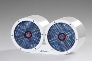
Large Aperture Scintillometers – BL S900
SKU: BL S900 -
Radar Wind Profilers – 3000 LAP
SKU: 3000 LAP -
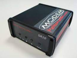
Radiosounding ground station – SR10
SKU: SR10 -
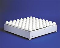
Sodar Wind Profiler – MFAS
SKU: MFAS -
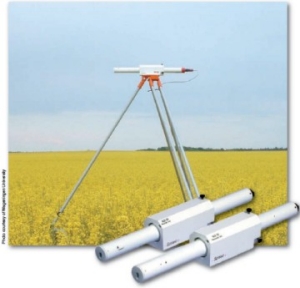
Surface Layer Scintillometers – SLS20
SKU: SL S20 -
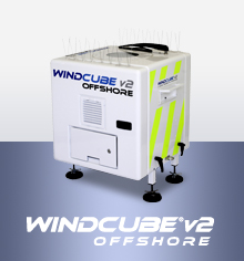
Vertical Wind Doppler Lidar – Windcube V2
SKU: Windcube V2 -
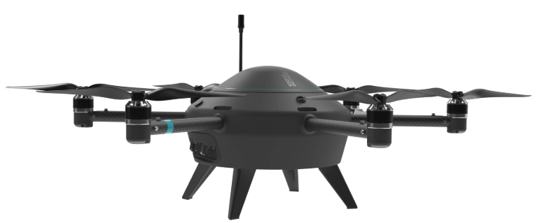
Weather Drones – MM-670
SKU: Meteodrone MM-670
Understanding the dynamics of the atmosphere cannot rely on ground-level measurements alone. To obtain a complete and accurate picture of weather conditions, air pollution and flight conditions, you need the ability to "see" the atmosphere in three dimensions – from the ground up to the upper layers of the troposphere. The Atmospheric Profiling category on the Meteo-Tech website brings together the world's most advanced and accurate remote sensing and vertical profiling equipment.
We offer a wide range of technologies – from microwave radiometers, through SODAR systems and wind LiDAR, to meteorological balloon launch systems (radiosondes). The equipment is designed to serve airports, power plants, climate research institutes, environmental authorities and military and defense units, while ensuring the highest reliability and full integration with data acquisition systems (data loggers).
What Is an Atmospheric Profile and Why Is It Essential?
An atmospheric profile is a vertical cross-section of the atmosphere that shows how meteorological variables – such as temperature, humidity, wind speed, wind direction and aerosol concentration – change with altitude. This measurement reveals thermodynamic and kinematic phenomena that are not felt at ground level, yet have a decisive impact on our lives.
For example, accurately detecting the inversion layer – a condition in which temperature increases with altitude and prevents the dispersion of pollutants – is critical for air quality management in densely populated cities. Similarly, detecting wind shear at varying altitudes is critical for aviation safety during takeoffs and landings. Without advanced atmospheric profiling equipment, weather forecasting models lack critical initial data, and the ability to issue warnings of extreme weather events is significantly impaired.
Leading Technologies for Atmospheric Profiling
In our catalog you will find the cutting edge of active and passive remote sensing, delivering data at unprecedented resolution:
Microwave Radiometers (Microwave Radiometers - MWR)
These passive systems measure the natural microwave radiation emitted by gases in the atmosphere (mainly oxygen and water vapor). By spectrally analyzing this radiation at different frequencies, the radiometer calculates the temperature and humidity profile with high accuracy from ground level up to an altitude of 10 kilometers and more. Key advantages: continuous operation (24/7), no moving parts, real-time data, and the ability to operate in all weather conditions, including heavy rain or fog. These are ideal systems for climate research and for improving local forecasting models (nowcasting).
SODAR (SODAR - Sonic Detection and Ranging)
SODAR systems use sound waves (acoustics) to measure wind speed and direction at different altitudes (typically from tens of meters up to about 1,000 meters). The instrument transmits pulses of sound and analyzes the Doppler effect of the returning waves, which are scattered by thermal turbulence in the air. Key advantages: a cost-effective and reliable solution for wind profiling in the lower boundary layer (PBL). Ideal for wind farm siting surveys (Wind Energy Assessment), air pollution monitoring, and safety at small airports and airstrips.
Doppler Wind LiDAR (Doppler Wind LiDAR)
LiDAR uses optical technology – transmitting eye-safe infrared laser beams and measuring the light returned from dust particles and aerosols carried by the wind. Analyzing the Doppler shift of the returned light enables accurate calculation of the three-dimensional wind vector. Key advantages: very high spatial and temporal resolution. Measurement ranges reaching several kilometers. LiDARs are today the gold standard in the wind energy industry, in wind turbine optimization, and in detecting complex airflows (wake turbulence) behind aircraft or turbines.
Radiosondes and Meteorological Balloons (Radiosondes)
The traditional, long-established method, which is still considered the global benchmark for atmospheric measurements across all layers. A radiosonde is a small sensor package (including temperature, humidity and atmospheric pressure sensors and a GPS receiver) attached to a helium or hydrogen balloon. As the balloon rises to altitudes exceeding 30 kilometers (the stratosphere), the sonde transmits data in real time to a ground receiving station. Our offering: we supply receiving stations, meteorological balloons, high-accuracy radiosondes, and fully automatic systems (Autosondes) for launching balloons with no human intervention – an ideal solution for national meteorological services and the military.
Atmospheric Profiling in Israel – Local Challenges and Equipment Adaptation (GEO Targeting)
Israel's geographic and topographic location creates a unique and complex climate. Selecting equipment for atmospheric profiling in Israel requires specific attention to local conditions:
- Coastal Plain Inversions and Air Pollution: the combination of sea breezes and mountain ridges (the Carmel, the Judean Mountains) causes a high frequency of low inversions and pollutant "traps" in the Haifa Bay, the Gush Dan metropolitan area and Jerusalem. Radiometer (MWR) and SODAR systems deployed in these areas are critical to the environmental monitoring network for forecasting and monitoring severe air pollution events and managing emissions from heavy industry.
- Suspended Dust Events (Dust Events): the transitional seasons (spring and autumn) are characterized by Sharav lows and dust transport from North Africa and the Syrian Desert. LiDAR technologies deployed in the Negev or the Arava provide an accurate atmospheric cross-section that makes it possible to distinguish between cloud layers and dense dust layers – information that is critical for climate forecasts and flight safety.
- Aviation and Extreme Terrain Conditions: from the airports in central Israel to Ramon Airport in the south, the effects of strong crosswinds and sudden wind shear require accurate data. The equipment we offer withstands the extreme temperatures of the Israeli summer and the high humidity levels along the coastline, and includes active cooling systems (HVAC) where required.
Applications and Industries: Who Needs to Measure Atmospheric Profiles?
The scientific and industrial equipment in this category is a strategic investment for a wide range of sectors (B2B / B2G):
- Airports and Aviation Safety: detection of wake vortex and wind shear, and management of landing and takeoff approaches to increase runway capacity and maintain maximum safety under ICAO standards.
- Renewable Energy (Wind Farms): conducting bankability studies for wind farm development using SODAR- or LiDAR-based virtual meteorological masts, with no need to erect tall, expensive masts. Real-time monitoring to optimize blade pitch angle on operating wind turbines.
- Meteorological and Climate Research and Academia: collection of climatology data, calibration of weather satellites, and research into global warming and the planetary boundary layer. The equipment integrates seamlessly into university research laboratories and science institutes.
- Military Defense and Security: atmospheric profile data is critical for ballistic calculations, dispersion of agents (CBRN), planning of air missions and parachute drops, and understanding the propagation conditions of radio and radar waves (ducting) in the lower layers of the atmosphere.
A Guide for Procurement Staff and Engineers: How to Specify and Select an Atmospheric Profiling System?
When selecting advanced meteorological equipment of this scale, it is important to define the system requirements precisely. Meteo-Tech supports buyers, procurement managers and project engineers from the specification stage through to installation. Here are the key points to consider:
- Measurement Purpose and Required Parameters: do you need a wind profile only (SODAR or LiDAR will suit this), or a full thermodynamic profile including temperature and humidity (which requires an MWR radiometer or radiosondes)? Combining technologies (synergy) is often the most comprehensive solution.
- Altitude Range and Vertical Resolution: SODAR systems are generally suited to measurements up to about 1,000 meters. LiDARs can reach several kilometers. Radiometers and radiosondes measure the entire troposphere (up to about 10-30 km). The instrument's range should be matched to the requirements of the project or laboratory.
- Environmental and Installation Conditions (Ruggedness): will the instrument be installed on a ship, in a desert area, or in a snowy area? Make sure the system includes appropriate IP protection (at least IP65-IP66), internal climate control (cooling, and heating to prevent condensation), and vibration resistance.
- Software and Communication Compatibility (Data Management): make sure the system provides data output in standard formats (NetCDF, ASCII) and supports modern communication protocols (TCP/IP, Modbus, serial ports). Our systems allow seamless connection to enterprise data acquisition software (data loggers) and secure clouds.
- Service, Calibration and Maintenance (TCO - Total Cost of Ownership): these systems require seasonal calibrations (such as liquid nitrogen calibration for radiometers). Check the availability of local service in Israel. Our engineering team provides calibration services, original spare parts and fast technical support in Israel.